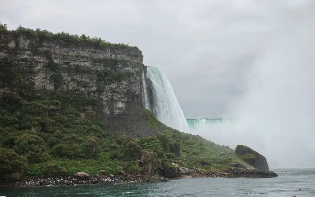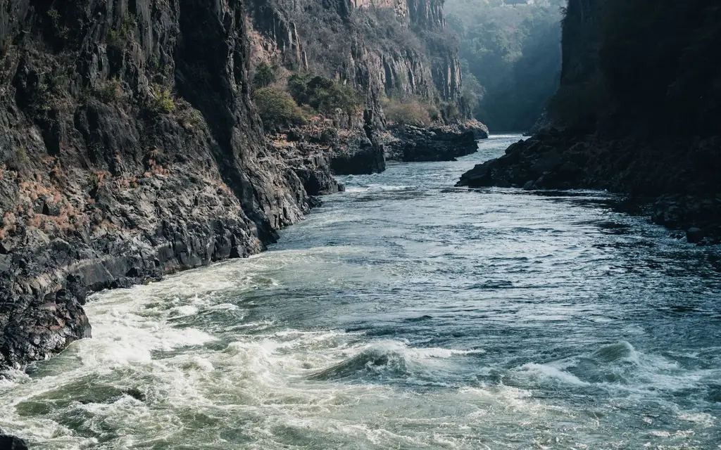
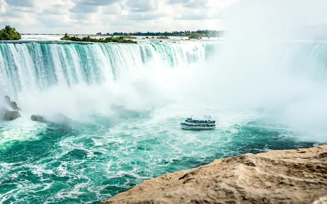
Start at the Horseshoe Falls and walk north, and within a couple of kilometres the Niagara River changes character completely. The broad, slow water above the Falls becomes a green torrent squeezed between limestone walls, and the hotels give way to forest. The Niagara Gorge trail network follows that canyon on both banks, from paved paths along the rim to rough stairs and boulder fields at the water's edge.
The problem every hiker meets is geometry. The gorge runs roughly north for about 11 km from the Falls to Queenston, and most good walks are linear. Walk out and back and you see everything twice; leave a car at one end and you have to retrieve it. A one-way hike with a pre-booked pickup removes that problem. This guide from NiagaraFallsLimo.net sets out the point-to-point options we see hikers choose most, with road distances so you can judge the time, and the rules that matter on each bank.
Can you hike the Niagara Gorge one way and get picked up?
Yes. On the Canadian side, hikers often walk from Table Rock to the Niagara Glen (about 7 km by road) or from the Glen to Queenston Heights (about 7 km more) and meet a car at the far trailhead. NiagaraFallsLimo.net books the drop-off and timed pickup online, with a fixed fare shown before you pay.
The pickup points we use are the public parking areas Niagara Parks already runs along the Niagara Parkway: the Niagara Glen lot at 3050 Niagara Parkway, Queenston Heights Park at 14184 Niagara Parkway, and the Falls lot by Table Rock. On the New York side, the state park trailheads serve the same role. Each is a place a car can legally wait, and each is easy to describe to a chauffeur.
The two banks are different hikes
The Canadian rim is gentle. The Niagara River Recreation Trail is a 53 km paved path for walking, jogging and cycling that runs from Fort Erie to Niagara-on-the-Lake, built in 1986 and now cared for with help from the Niagara Parks Foundation, according to the Niagara River Recreation Trail page. Between the Falls and Queenston it runs close to the Parkway along the top of the gorge, with lookouts over the rapids. Below it, reached by stairs, the Niagara Glen is the rugged contrast.
The American rim has the dramatic floor-level trails. The Niagara Falls State Park hiking page describes a gorge trail system with easy trails and "challenging sections" that include steep stairs and rock scrambling, and it insists that hikers stay on marked trails and stay out of the water.
You can do either side in a morning. Doing both means crossing the Rainbow Bridge, so everyone needs their documents; more on that below.
Canadian side: three one-way walks with a car at the end
Table Rock to the Niagara Glen (rim walk)
Distance by road is about 7 km (4.5 mi); the recreation trail runs beside it. For a steady walker that is roughly an hour and a half to two hours, with stops. You pass the Whirlpool Rapids, the White Water Walk building and the Whirlpool Aero Car before the Glen. It is paved, mostly level and good for anyone who wants scenery without a climb. Your car meets you at the Niagara Glen lot, where Niagara Parks charges CA$8 per hour as of 2026 to anyone parking there.
If you want to see the rapids at water level on the way, the White Water Walk boardwalk is a ticketed stop on this stretch, open from April to November.
Into the Niagara Glen and back up (the hard part)
The Niagara Glen is the real gorge hike on the Canadian side: stairways down from the rim lead to about 4 km (2.5 mi) of rugged trails through old-growth Carolinian forest, most of them classed by Niagara Parks as moderate. The rules on the Niagara Glen page are firm: hiking only between sunrise and sunset, dogs on leash, no cycling or swimming, and carry out what you carry in. Bouldering permits are sold at the Nature Centre.
Two closures matter this autumn. Part of the Terrace Trail, between the Cobblestone and Trillium trails, and the whole of the Whirlpool Trail were closed for maintenance in fall 2026, so check the page before you go. Because the Glen's trails start and finish at the same stairs, this is a loop rather than a one-way hike; book the car to wait, or combine it with one of the rim walks.
Our dedicated guide to a Niagara Glen hiking day goes deeper on the trails and the Nature Centre.
The Niagara Glen to Queenston Heights
The road distance is about 7 km (4.5 mi) again. North of the Glen the rim trail passes the Niagara Parks Botanical Gardens and the Floral Clock area before reaching Queenston Heights Park on top of the escarpment. Niagara Parks notes that Queenston Heights is the southern end of the Bruce Trail, Canada's oldest and longest marked footpath, so your hike ends where that famous trail begins. The pickup point is the park's lot at 14184 Niagara Parkway, beside Brock's Monument. Our post on Queenston Heights and Brock's Monument covers what to see there.
Walked together, Table Rock to Queenston is around 11–12 km (7 mi) by road, a satisfying half-day for fit walkers with no backtracking at all.
Price a drop-off and pickup for your hike
Niagara Gorge trails on the New York side
Niagara Falls State Park says its gorge trails begin at the Niagara Gorge Trailhead Center, in front of the Aquarium's Great Lakes 360 building, and it publishes these times for each walk done as a round trip:
- Great Gorge Scenic Overlook Trail: easy, about one hour round trip, no age limit, from the Trailhead Center.
- Upper Great Gorge Trail: easy, about two hours round trip, following the Great Gorge Railway Trail, no age limit.
- Devil's Hole Rapids and Giant Rock: moderate, about 2.5 hours round trip, from Devil's Hole State Park, ages 8 and up.
- Whirlpool Rapids Adventure Trail: among the most challenging, about three hours round trip with some rock scrambling, from Whirlpool State Park, ages 8 and up, recommended for experienced hikers.
The park also runs guided gorge hikes from mid-May through October, with a five-person minimum for groups.
For a one-way plan, the useful fact is that these walks start from three different trailheads spread along the gorge: the Trailhead Center by the Falls, Whirlpool State Park about 3–4 km (2 mi) north by road, and Devil's Hole State Park further north again. Check the current state park trail map to confirm which sections connect and are open, then set your drop-off at one trailhead and your pickup at another. Driving back to Fallsview from Devil's Hole is about 10–11 km (6.6 mi), usually 15–20 minutes plus the bridge.
Crossing the river for a US-side hike
The Rainbow Bridge links the two cities of Niagara Falls a few minutes from Clifton Hill. Your chauffeur crosses with you, but every hiker must carry their own valid documents: a passport, passport card, enhanced driver's licence or NEXUS card for Canadians and Americans, and a passport plus approved ESTA or visa for most other visitors. See documents for entering the USA and our Rainbow Bridge page. Tolls are collected only on the way back into Canada. We never promise a crossing time; summer weekend afternoons are typically the slowest, so a morning hike and an early return are the easy combination.
Two other border notes for hikers: do not carry cannabis in either direction, and if you hike the Canadian side first and then cross for a second walk, knock the mud off your boots before the bridge; CBP's agriculture rules ban bringing soil into the United States without a permit.
Chauffeur vs rideshare vs taxi for this trip
| Option | Door-to-door time | Cost note | Gear | Best for |
|---|---|---|---|---|
| Private chauffeur, timed pickup | Car waits at the far trailhead | Fixed fare via booker | Packs, poles and a change of shoes stay in the car | One-way hikes, groups, cross-border hikes |
| Rideshare app | Quick drop-off near the Falls | Surge pricing at busy times | Day pack only | Getting to the start from a hotel |
| Taxi | Reliable from a hotel rank | Metered | Day pack only | Short hops on the Canadian side |
| WEGO visitor bus | Fixed routes and timetables | Niagara Parks pass or fare | Day pack only | Rim walkers on the Canadian side in season |
| Walking back | Doubles the hike | Free | Whatever you carry | Strong hikers who enjoy the return leg |
The honest verdict: for the start of a Canadian rim walk, a taxi or rideshare from your hotel to Table Rock is fine; it is a short ride. The weak point is the finish. Hailing a car at the Niagara Glen or Queenston Heights after a long walk can mean a long wait, and on the US side a rideshare will not carry you back across the bridge reliably. A pre-booked car that is already at the far trailhead, holding your dry socks, is what makes a one-way hike work, especially for groups or anyone crossing the border.
Practical points before you set off
- Daylight. The Glen is sunrise-to-sunset only; Niagara Parks warns that parts of the gorge get dark sooner than you expect. Book pickups with an hour of daylight to spare.
- Footwear and water. The State Park asks for sturdy footwear and water on every gorge trail.
- Pickup timing. Agree the pickup time when you book and add a buffer; mobile signal may be patchy below the rim. With hourly chauffeur service the car simply waits.
- Seasons. Spring stairs can be wet and icy patches linger in winter. Summer is busy at the Falls end, quiet in the Glen. October brings the colour and the shortest days.
- Water. Never enter the river. Niagara Parks rates the Whirlpool Rapids as Class 6, with water moving at about 48 km/h (30 mph).
Who this suits
Individuals on a solo trip get a structured half-day with a guaranteed ride at the end; see our notes for solo travellers. Couples often pair a morning hike with lunch in Queenston or Niagara-on-the-Lake. Families with older children can take on the easier State Park trails, though the park sets an age-8 minimum on the two harder routes. Groups of walkers fit in an SUV (up to 6) or an Executive Sprinter (up to 12), and the State Park's guided hikes take groups of five or more. For an adjacent day, our Niagara Glen and Botanical Gardens page links the gardens to the trails.
Booking it with NiagaraFallsLimo.net in 3 steps
- Set the start and finish. Pickup at your hotel, drop-off at the trailhead (Table Rock, the Niagara Glen lot or a State Park trailhead), then a return pickup at the far trailhead with a time.
- Choose the car. Sedan for up to 3 hikers, SUV for up to 6 with packs, Sprinter for a club. Each shows its fixed fare.
- Add notes and pay. Boots-in-the-car, poles, passports for a crossing; pay securely and the confirmation comes by email.
Everything is done on the online booker in a few minutes.
Frequently asked questions
Is there a trail along the Niagara Gorge on the Canadian side?
Yes. The Niagara River Recreation Trail is a 53 km paved path from Fort Erie to Niagara-on-the-Lake, and between the Falls and Queenston it follows the top of the gorge beside the Niagara Parkway. Below the rim, the Niagara Glen has about 4 km of rugged trails reached by stairs.
How hard are the Niagara Glen trails?
Niagara Parks classes most Glen trails as moderate, suitable for hikers with basic trail experience, with stairs at the start and rough, rocky footing below. Hiking is permitted only from sunrise to sunset, and some trails were closed for maintenance in fall 2026, so check before you go.
Which is the hardest gorge trail on the US side?
Niagara Falls State Park describes the Whirlpool Rapids Adventure Trail, starting from Whirlpool State Park, as among the most challenging in the park: about three hours round trip with some rock scrambling, recommended for experienced hikers and only for ages 8 and up.
Do I need a passport to hike the American side?
Yes, if you are starting from Ontario. Every person in the vehicle needs valid documents to enter the United States and again to return to Canada. Canadians and Americans can use a passport, passport card, enhanced licence or NEXUS card; most other visitors need a passport and an approved ESTA or visa.
Where can the car pick us up at the end?
On the Canadian side, the Niagara Glen lot (3050 Niagara Parkway) and Queenston Heights Park (14184 Niagara Parkway) are the usual finish points. On the US side, the State Park trailheads at Whirlpool and Devil's Hole state parks work well. Your chauffeur waits there at the agreed time.
Can we bring a dog?
Dogs must be leashed at all times in the Niagara Glen. In our vehicles, trained service animals are always welcome; ask when booking about other pets, and bring a towel if the trail has been muddy.
When is the best season for gorge hikes?
Late spring and autumn are the most comfortable. Summer works if you start early, before the heat and the crowds at the Falls end. In late autumn daylight is short and the Glen closes at sunset, so plan a morning start and an early pickup.